Best Spots in Bryce Canyon National Park

Bryce, home of the HOODOOS. What a funny word right? If you're like me, you initially had no idea what the heck hoodoos are either. Hoodoos are a geology term in reference to the "tall, thin spire of rock that protrudes from the bottom of an arid drainage basin or badland" (according to Wikipedia). These unique shaped rocks draw many people near and far and prove to be quite mesmerizing. We visited Bryce Canyon National Park just for a day, but managed to squeeze in three different viewpoints/hikes along the way! We paid $30 per vehicle (which was only one car for us) to get into the national park and the pass is actually valid for 7 days! Listed below are the three spots we visited:

Sunset Point (Navajo Trail)

IMG_8542.jpg

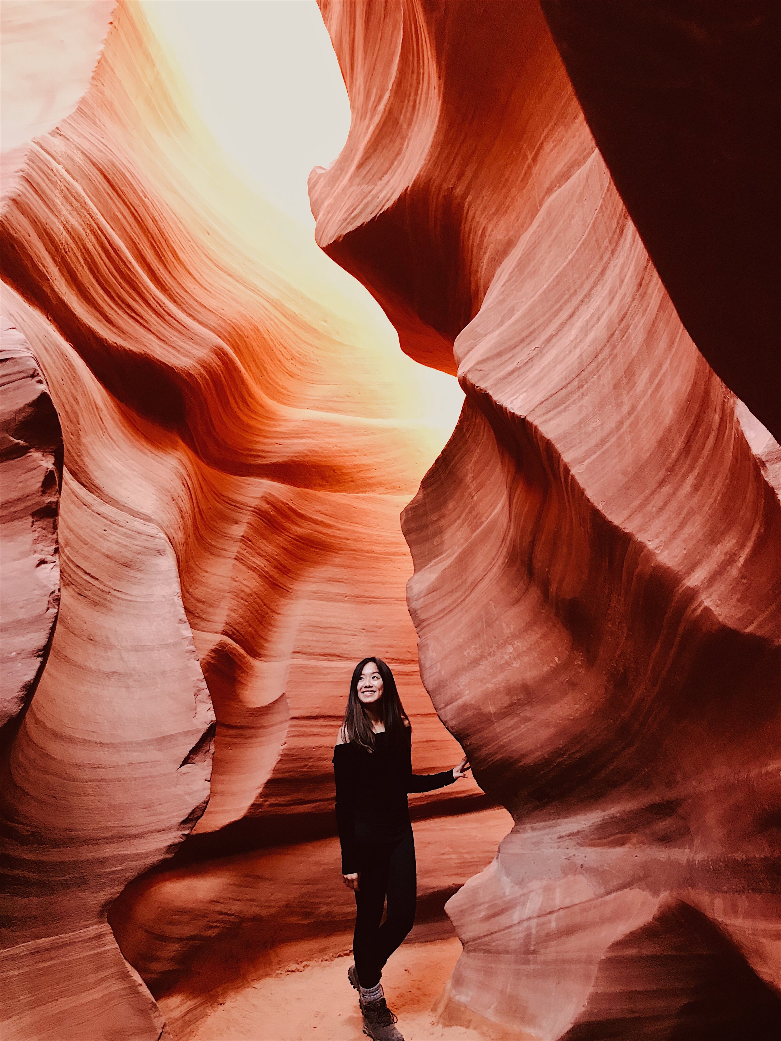
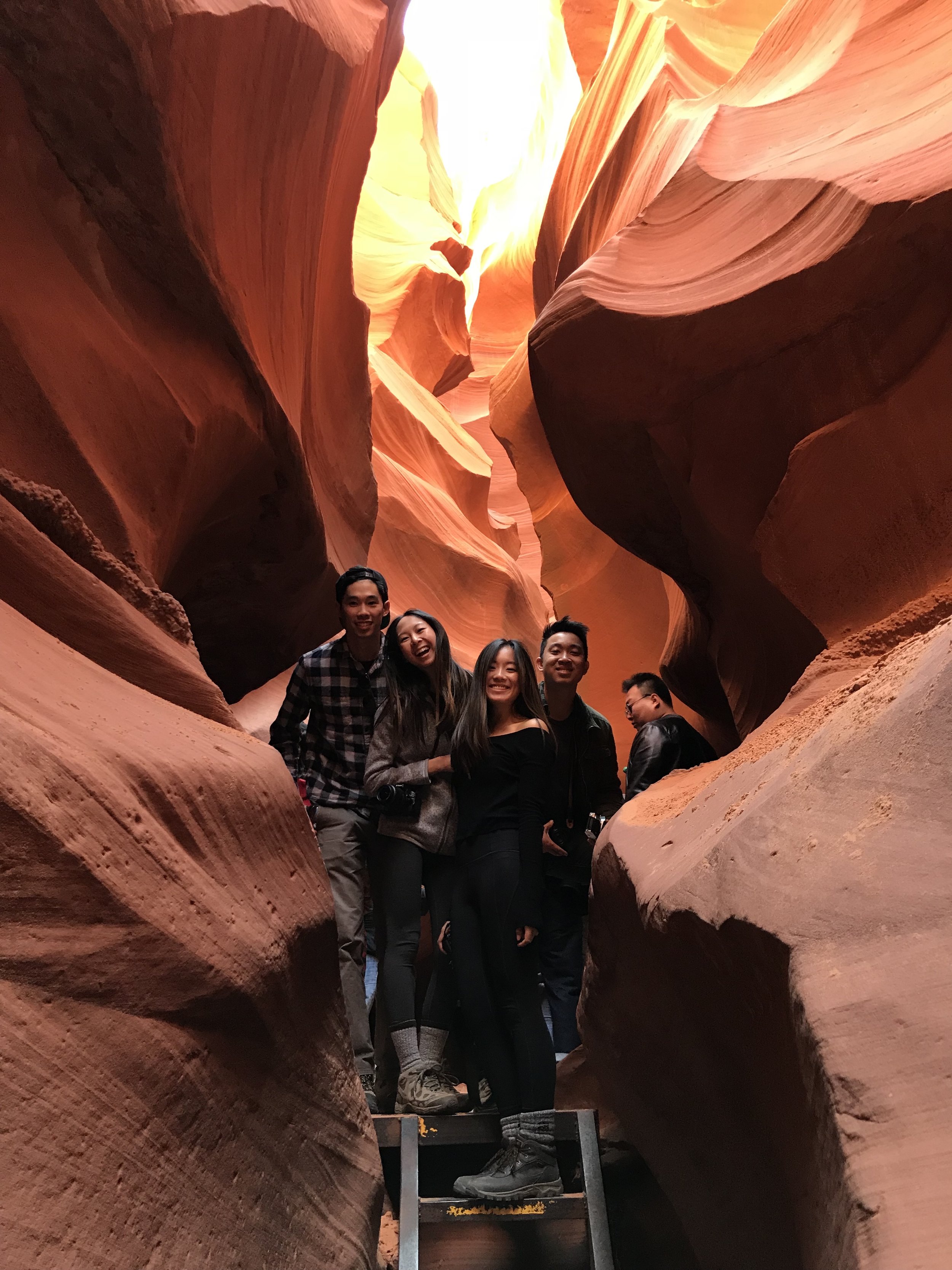
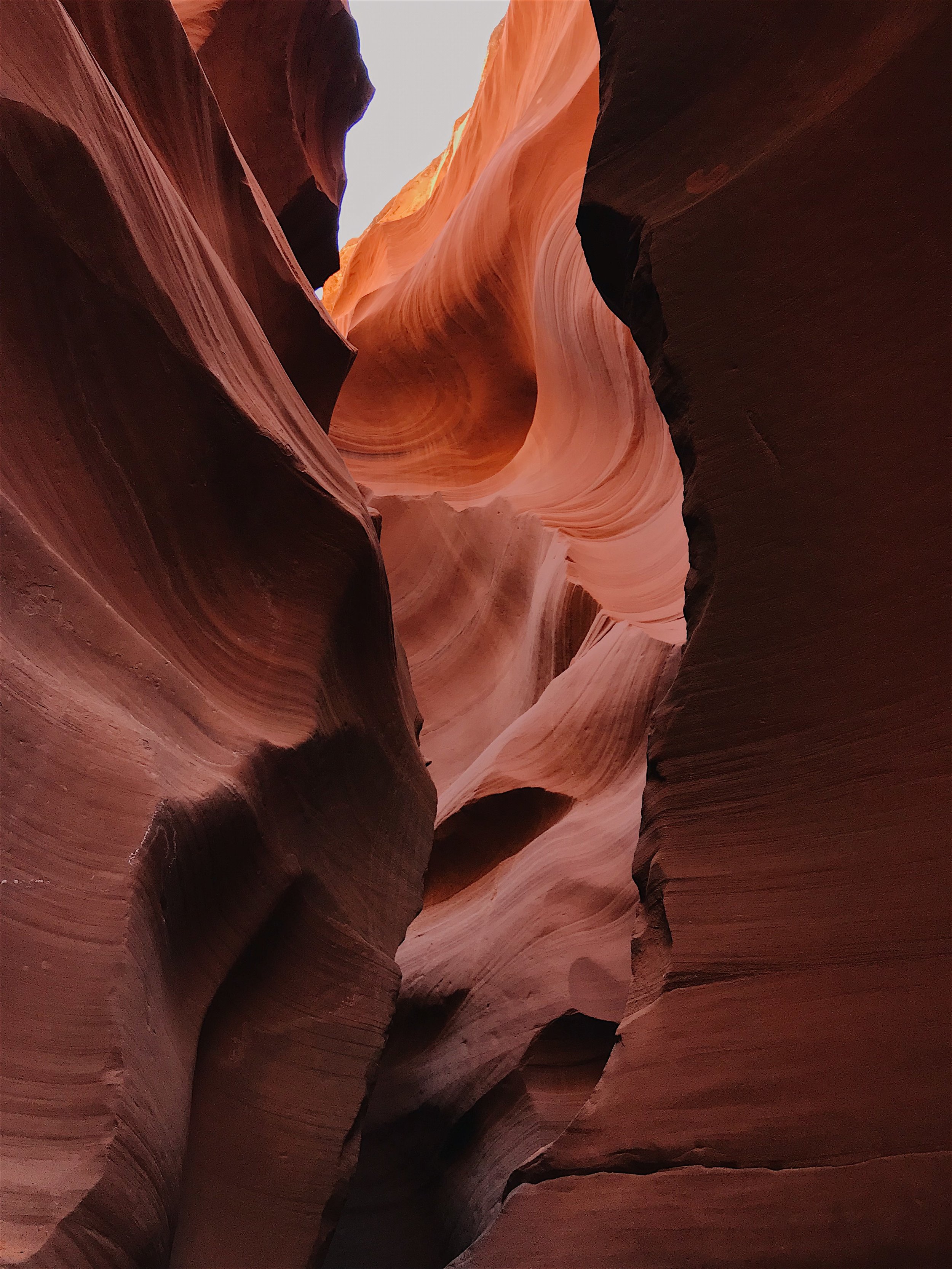
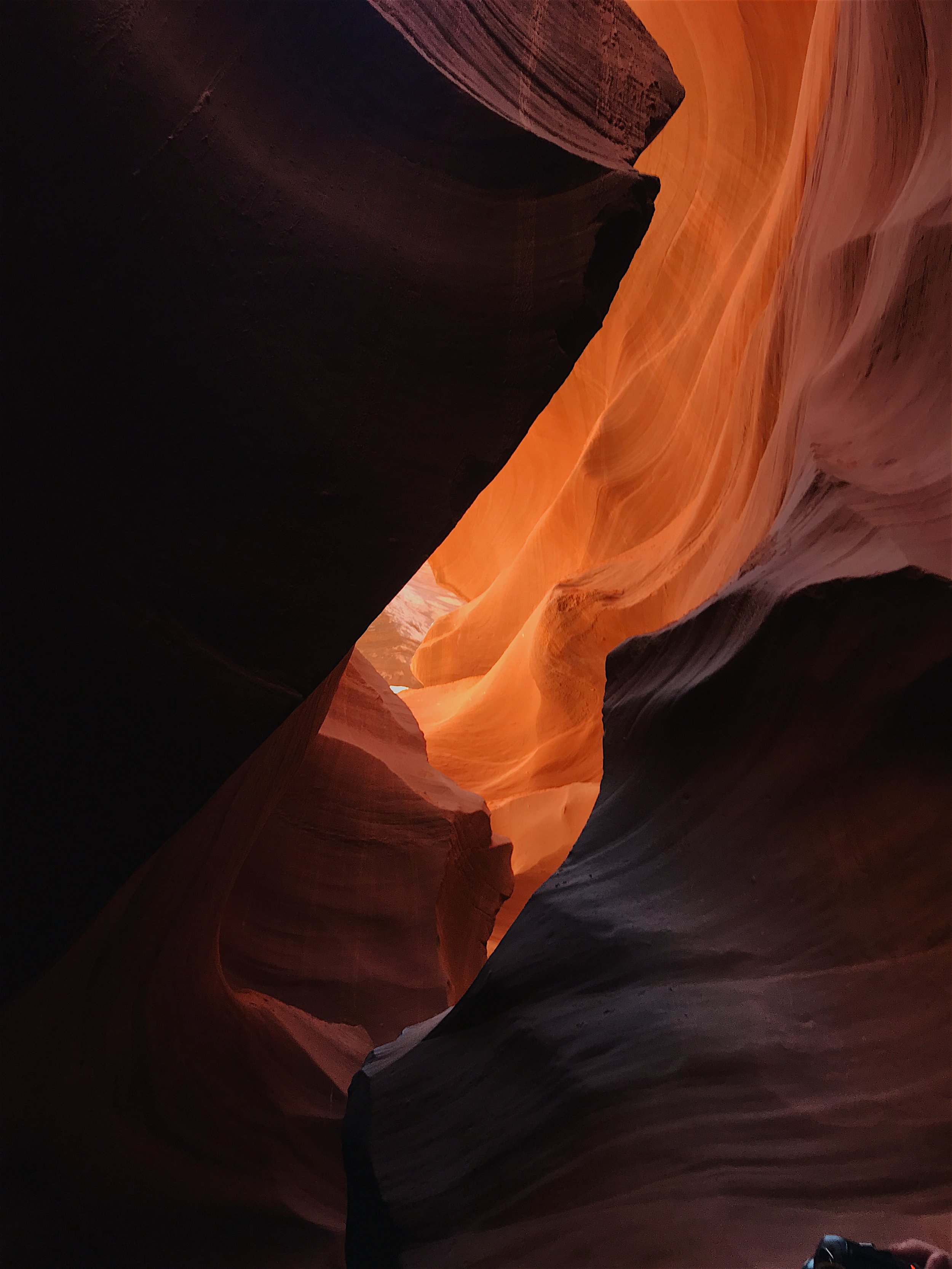
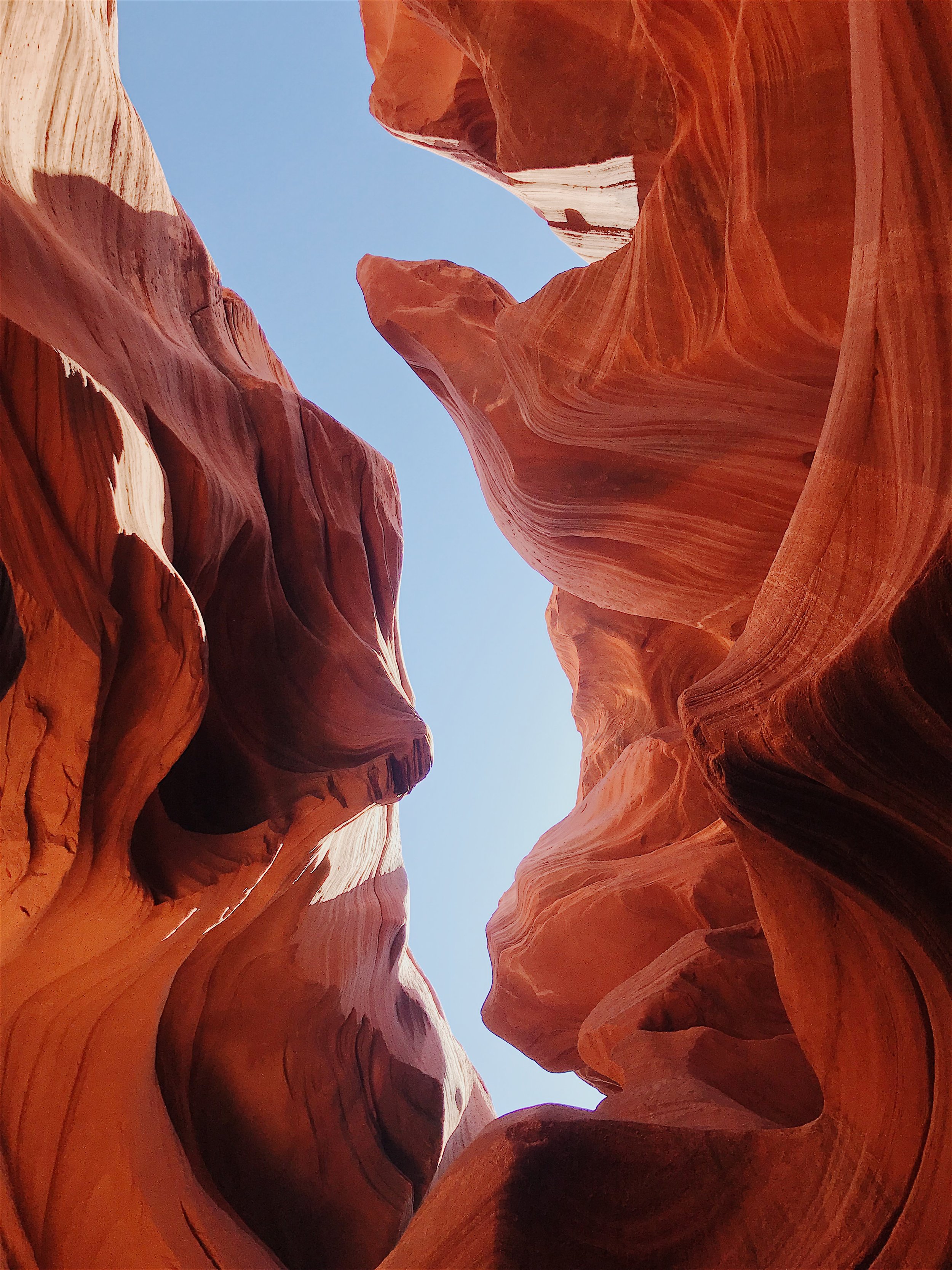
This particular hike was my absolute FAVORITE. I probably started to annoy my friends when I could not stop saying that I wanted to  walk down into and in between all of the hoodoos. I'm pretty sure that within the day I mentioned it at least 7 times. I just wanted to explore man! This particular hike was actually unplanned, and we were initially driving to another viewpoint, which ended up being closed off for unknown reasons. We debated on just giving up on the spot, but instead we spontaneously picked a nearby spot on the map and chose this spot merely because it was named the "Sunset Point" and it was almost time to watch the sunset. Spontaneous decisions are often the best ones, because then my wish to hike down into the rock formations finally came true! I found the pinkish-orange tint of the sand and rocks to be extremely alluring, and I had wished we found this trail sooner so we could have explored the path even more deeply! Spend the next few seconds scrolling through the following photos, gawking in admiration at the colors of this gorgeous hike with me.

IMG_8526.jpg
IMG_8603-3.jpg
IMG_8607.jpg
IMG_8597.jpg

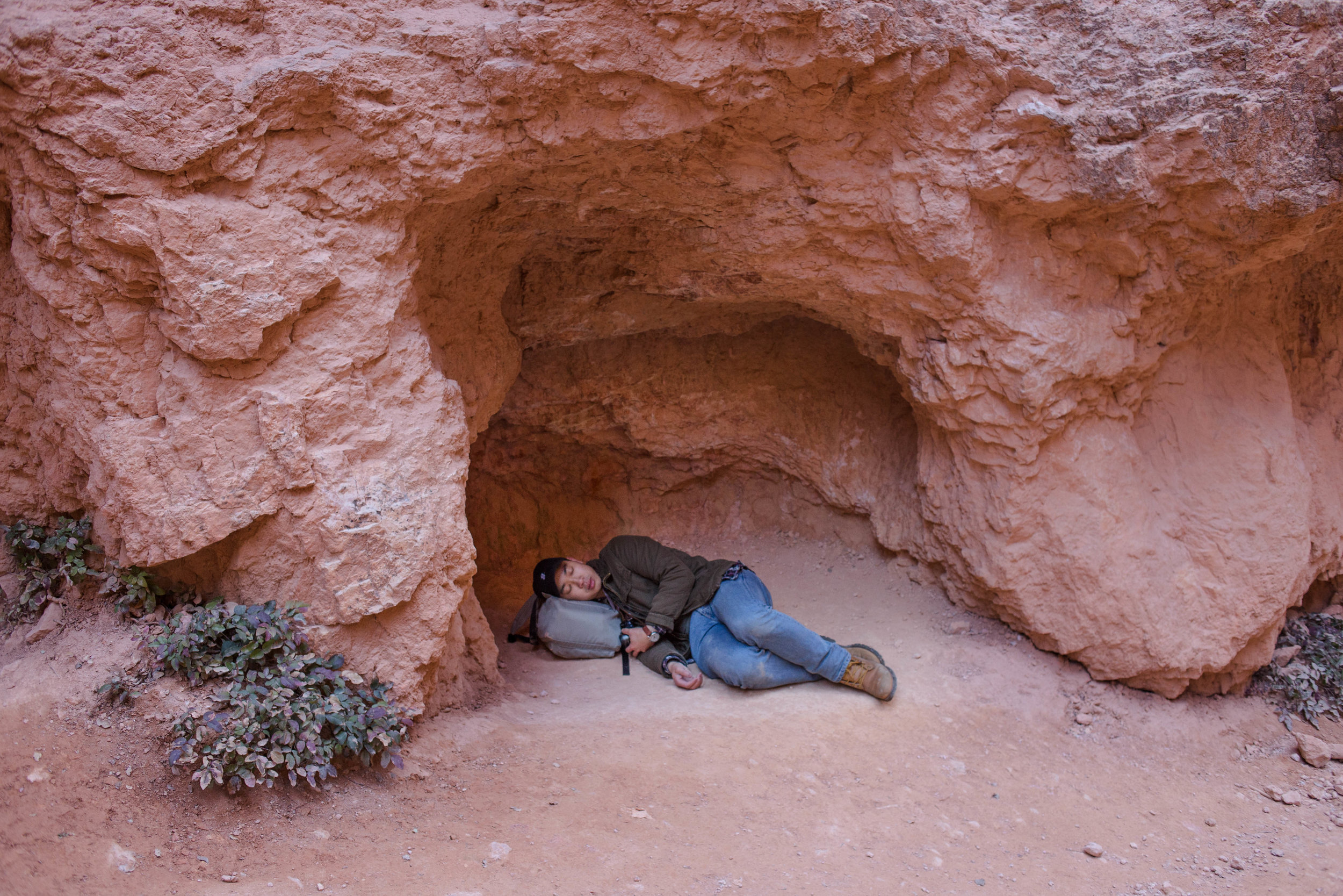
This Navajo Loop Trail is only a 1.3 mile roundtrip hike, with 550 feet (or 167 meter) elevation gain. It was pretty easy on our feet and burned our thighs quite a bit on the hike back up, but it is overall pretty relaxing! It was visually a very intriguing hike. The hike featured beautiful high-up views of hoodoos and trees, a gorgeous switch-back section, and some cute little hole-like rock formations that Harry thought it would be cozy to take a nap in.  Our group never made it all the way around the loops since we were losing sunlight very quickly, but I encourage everyone to finish the entire hike!  It begins at Sunset Point, not far from the parking lot, and goes all the way down to the main amphitheater. For more information regarding the trail itself, click here.

Hello to the Hella Handsome Harry

Hello to the Hella Handsome Harry

Inspiration Point

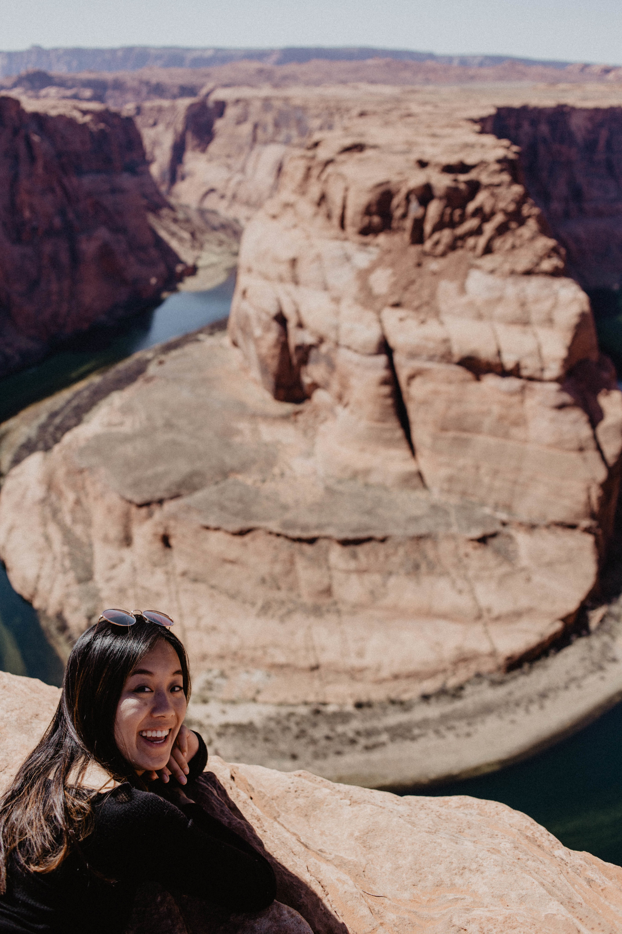
If you are looking for the iconic, well-known, picturesque view of Bryce National Park, this is probably the spot for you. Inspiration Point is again marked by the tall orange tinted hoodoos, a trail-way to walk that extends along the mountainside, and a tall cliff which you see me standing on in the photo pictured below. I obviously was not brave enough to go all the way to the edge but hey, good enough right? I promise, it's taller than it looks! I really loved this particular viewpoint because it provides a varied collection of views of the amphitheater. You can climb up to the top of the hill to look down in awe of the vastness of it all, or walk down the path a little bit and get a little bit closer to the hoodoos, where you can see a gorgeous lateral view of the natural structures. I love the warm orangey-pink tones of the canyon and could honestly see myself sitting, sipping some boba (sadly I had no boba with me at the time, sigh), looking at this view for hours on end. When we visited this particular viewpoint, it was not too crowded, which made the experience much more enjoyable! It was a vast, peaceful scene that really reminded me of how magnificent and big God made nature to be, and made me so thankful to be able to be a part of it.

IMG_8359.jpg
IMG_8372.jpg
IMG_8389.jpg
IMG_8447.jpg
IMG_8467.jpg
Shot on Iphone

Shot on Iphone

Bryce Point

Bryce Point was expansive! It was one of the more crowded viewpoints we visited since it is definitely more well-known. From the parking lot, the trail led to a fenced-off viewpoint at the edge of a cliff, providing close to a 360 degree view of the canyons. I thought the weaving greenery of the trees between the warm tones of the many rocky hoodoos made this particular site especially beautiful. A branch of the trail was closed off, so I believe it opens up to the public later on in the year during the warmer months, but I was itching to explore! This viewpoint was a bit cold and windy, even in the end of March, so make sure to bring layers, hats, gloves, etc. Our fingers were freezing trying to take photos! I've heard that the sunrises are Bryce Point are mind-blowing. I can only imagine the intertwining reds, oranges, and yellows that result when the sunbeams hit the tall hoodoo tops. Our group didn't quite make it for sunrise since we traveled to Bryce National Park early morning from a further location, but it is on my bucket list to come back and see a proper Bryce sunrise. One day (:

IMG_8239.jpg
IMG_8215.jpg
IMG_8233.jpg

For a general overview of the itinerary we took for our 5 day roadtrip through Utah and Arizona, visited this page. Bryce is higher up in elevation though, so it proved to be much colder than the other spots in Arizona and Utah we visited during our roadtrip. Bring layers! Fallin' in love with the desert more and more every day I spend here.. EEP! 

Visiting Arizona

For my spring break, I jumped at the chance to do a road trip to the desert land next door, Arizona! Click here for a simple guide on our roadtrip itinerary! After passing through Utah, we hopped on over to Arizona and stayed in Page for the night. It was a nice change in environment because there was a variety of restaurant and food options, something we missed out on while staying at smaller cities in Utah. Our favorite two destinations included the Lower Antelope Canyons and Horseshoe Bend!

Visiting the Antelope Canyons definitely fell on the top of the priority list when we decided we were going to travel to Arizona. It's one of those, infamously gorgeous spots, that also felt a little bit basic cause, yannow, everyone goes there. I have to admit that I initially wasn't the most excited for the canyons, because I thought -like many trendy things nowadays- it was probably overhyped. But the moment I stepped foot inside, I legit could not stop gawking. No photos do it justice, and I would highly recommend it to anyone visiting Arizona. When you first approach it, it looks like a bunch of sandy desert ground with a long crack in the ground. We debated for a long time on visiting the Upper vs Lower Antelope Canyons. The Upper Canyon has the benefit of seeing the light beams, but are often more expensive and crowded. The Lower Canyon is less crowded, slightly less expensive, and has many stairs to climb up and down. We opted for the less crowded and less expensive option, and we did not regret it in the slightest. To visit either canyon, it is required to book a tour! We decided to go with Dixie Ellis' Sightseeing Tours, at about $38.10 per adult. We had an amazing experience touring with them!

IMG_8761.jpg
IMG_8731.jpg
IMG_8755.jpg

Our group was still adapting to the slight time changes between all the different states. A thing to note, most of Arizona does not observe daylight savings time from March through November each year.  From March to November during the Daylight Savings adjustment, Arizona is on Pacific Daylight Time (PDT). The remaining portion of the year, Arizona operates under Mountain Standard Time (MST). Now, this is pretty confusing, but important to understand when you are trying to make it to your tour on time. For us, we were driving from just inside the border of Utah to Antelope Canyon for our tour, and did not even realize that Arizona was operating under PDT while Utah was operating under MST until a kind waiter casually mentioned it to us. Honestly, it was kind of hard for us to organize and keep track, so what we did was just google "What time is it in Arizona" and went with that haha. Iphones often automatically change for you as well, but something good to be aware of! 

What the canyons look like from the top down view! Shot on Iphone.

What the canyons look like from the top down view! Shot on Iphone.

IMG_8736.jpg
IMG_8802.jpg
IMG_8806.jpg
IMG_8816.jpg

Our group ended up being a little bit late to our tour (our tour was scheduled to begin at 11:15AM and we arrived at 11:13AM so not TECHNICALLY late), but the tour group was very accommodating to us and even though our group had already left, they stuck us with another tour guide and we ended up getting a private tour for the four of us! Although I am not recommending anyone to be late on purpose so you get a "private" tour, we were all very thankful for still getting to attend the tour despite our lateness! We ended up getting paired with Wila, the funniest, most chill tour guide who was not only full of Navajo history and geology facts, but also knew ALL the best photo spots. He grabbed my phone out of my hand and initially I looked at him like "uh excuse me dude" but then he pointed to a perfect nook in the canyon and said "go stand there and look up" and snapped quite a few photos of the each of us. By the end of the tour, maybe because he heard me and Phoebe call out to our boys constantly for pictures, he learned all of our names and we all joked around like we were friends. We laughed so much, and Wila kept us on schedule (cause honestly if there was no tour me and Pheebs would probably have spent like 3 hours inside snapping photos) while still giving us opportunities for gorgeous photos. Coming out towards the end, the tour offered all of us waters to keep hydrated, which was a gesture we all highly appreciated. 

IMG_8727.jpg
IMG_8725.jpg
IMG_8723.jpg
IMG_8696.jpg

The colors are beyond amazing, and it is slightly frustrating because none of the photos do the canyons justice. The tour took about an hour, but honestly it flew by way too quickly. If we had more money I'm sure we would've wanted to visit the Upper Canyons as well, just to compare, but overall the Antelope Canyons was among everybody's favorites of the entire trip. 

IMG_8863.jpg

Only a short drive from the Antelope Canyons, our next stop was to visit Horseshoe Bend! The hike was very short, only 0.75-ish miles to the view point from the parking lot. It was a little bit crowded, also probably because we went smack dab in the afternoon. Many people were climbing the edges, hanging their feet over, but goodness my stomach was fluttering like crazy. Phoebe pointed out it was probably due to the STEEP (girl when I say steep i mean like a freakin' straight drop down) hill edges. Nothing to break your fall if you slipped on over, so this viewpoint actually scared me way more than I expected. The Colorado River flowed beautifully in the horseshoe shaped bend, and it was still a beautiful sigh to behold! 

IMG_8854.jpg
IMG_8861.jpg

Thanks for the gorgeous views Arizona! Wish we could've stayed longer!